Located near the mouth of the Rio Grande, Bagdad played a vital role as a port city for Mexico and the Confederates during the Civil War. Although the ports of Texas were blockaded by Union warships, the Rio Grande was recognized as an international waterway. This allowed Mexican-flagged steamers to legally carry cotton brought into the Rio Grande Valley from other parts of Texas, Louisiana, and Arkansas to Bagdad. At times, as many as three hundred ships from England and other European nations were anchored off the coast of Bagdad awaiting shipments of the precious fiber. Important goods such as medicine, food, clothing, gunpowder, and rifles were subsequently smuggled through Bagdad as well. This small community, established in 1848, became a bustling city of 25,000 inhabitants that attracted cotton brokers, sailors, teamsters, gamblers, French and Austrian troops in the service of Emperor Maximilian, and various assortments of criminals. When Brownsville's cotton shipments were interrupted by Union occupation in November 1863, this transport moved west to Laredo. The war's end quickly brought the lucrative export business of Bagdad to an end, but it was the horrific hurricane of 1867 that had the final word: Mother Nature reclaimed the once desolate, salt-sprayed sand dunes and marshland and Bagdad now lives on only in history, tales, and memory.
Listen
Ubicada cerca de la desembocadura del Río Grande, Bagdad desempeñó un papel crucial como ciudad portuaria tanto para México como para los confederados durante la Guerra de Secesión estadounidense. Si bien los puertos de Texas fueron bloqueados por navíos de guerra unionistas, se reconoció el Río Grande como vía fluvial internacional, lo que permitió a los vapores bajo bandera mexicana acarrear algodón procedente de otras zonas de Texas, de La Luisiana o de Arkansas hasta El Valle del Río Grande a través de Bagdad de manera legal. En ocasiones, llegaron a fondear hasta trescientas embarcaciones de Inglaterra y de otras naciones europeas frente a la ciudad, a la espera de cargamentos de la preciosa fibra, pero también pasaban de contrabando por Bagdad otras mercancías importantes, como medicamentos, comida, vestimenta, pólvora y carabinas. Esta pequeña comunidad, fundada en 1848, se convirtió en una bulliciosa ciudad de 25 000 habitantes que atrajo a tratantes de algodón, marineros, arrieros, jugadores, soldados franceses y austriacos al servicio del emperador Maximiliano y un variado surtido de delincuentes. Cuando la ocupación de Brownsville por parte de fuerzas unionistas en noviembre de 1863 impidió la llegada de cargamentos de algodón desde esta localidad, su transporte se desplazó hacia el oeste, hasta Laredo. El final de la guerra puso rápido punto final al lucrativo negocio exportador de Bagdad, pero fue el terrorífico huracán de 1867 el que dijo la última palabra: la Madre Naturaleza reclamó para sí los marjales y las antiguas dunas arenosas, salobres y desoladas. Bagdad existe ahora sólo en la historia, los relatos y el recuerdo.
Escucha
Details
Location: End of Hwy South of Mouth of the Rio Grande
GPS Coordinates
Photos
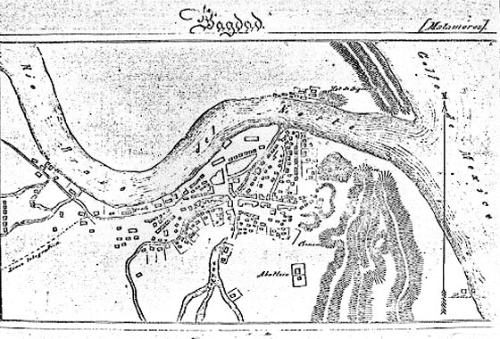
Bagdad- Mexico map
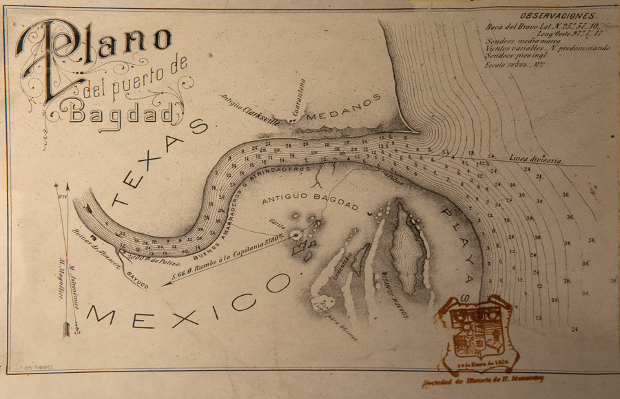
Map of the Port of Bagdad
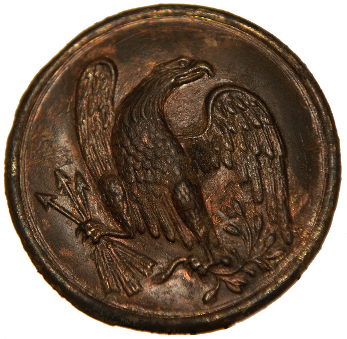
Union Breastplate for Cartridge Box Sling
Courtesy of the Port Isabel Historic Museum