Exposed in road cuts along US Highway 83 between Rio Grande City and the town of Escobares a distance of 15 km, is a white to tan colored, and up to 20 meters thick volcanic ash deposit. Geologic maps indicate it is the volcanic member of the Catahoula Formation, a distinct unit that today extends along the Gulf Coast from Texas to Alabama. The Catahoula volcanic ash can be traced for 180 km north to the city of Three Rivers, where it crosses Interstate 37, and in satellite imagery it is detectable for 40 km south of the Rio Grande.
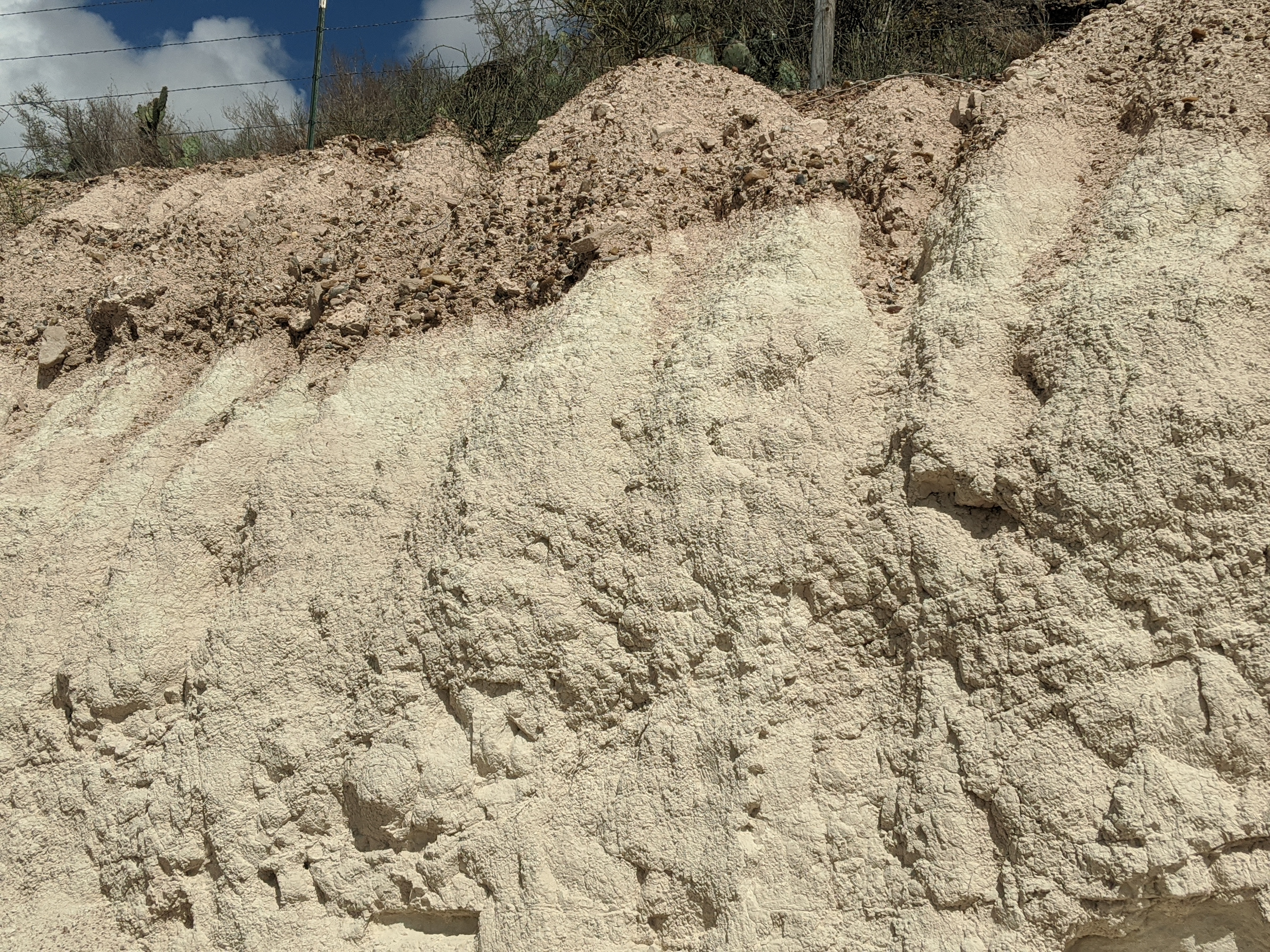
The time of the ash deposition has been determined at 27.4 million years before present; this corresponds to the Oligocene Epoch in the Geologic Time Scale, a time when the shoreline of the Gulf of Mexico was near Rio Grande City. Twenty meters of ash fell on the region and blanketed all landforms permanently changing the landscape. The light-colored ash is indicative of a “felsic” magma, a highly viscous type of magma known to produce violent eruptions when a caldera blows its top off. The exact location of the caldera remains undetermined but based on age and chemical affinity of the ash, likely candidates are several large calderas in the Sierra Madre Occidental in Mexico, over 500 km to the southeast of the Rio Grande Valley. The volcanic ash is the reason for two other sites of interest on the Ancient Landscapes map and trail, the Petrified Forest, and El Sauz Chert. It is also the source for the uranium that has been mined in south Texas for over fifty years in counties to the north of the Rio Grande Valley.
There are three easily accessible outcrops of the volcanic ash in the vicinity of Rio Grande City where it can be inspected, 1- behind Martinez Diesel Repair on the north side of HWY 83, just past the walled portion of the highway traveling west, 2- at the intersection of Tampico St. and Hidalgo Ave., this is the best exposure where 17 m of uninterrupted ash can be seen, and 3- at the La Santa Cruz shrine at the intersection of Hillside and Santa Cruz Rd.
Now visible as clay, the material in these outcrops was deposited as volcanic ash. The silica rich ash weathered over time to become the fine grained, white colored clay. So rich in silica, quartz crystals will precipitate out of the ash over time as rain water infiltrates. The source of the eruption that produced this ash is unknown but occurred 27 MYA. The ash is ~20 meters thick and bounded on the top by an unconformity with the Goliad formation. The base is in contact with the Lower Catahoula, Frio formation. The ash is part of the Catahoula formation but the outcrops here provide excellent viewing locations.