Catahoula Volcanic Ash
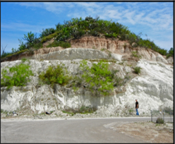
 Exposed in road cuts along US Highway 83 between Rio Grande City and the town of Escobares a distance of 15 km, is a white to tan colored, and up to 20 meters thick volcanic ash deposit. Geologic maps indicate it is the volcanic member of the Catahoula Formation, a distinct unit that today extends along the Gulf Coast from Texas to Alabama. The Catahoula volcanic ash can be traced for 180 km north to the city of Three Rivers, where it crosses Interstate 37, and in satellite imagery it is detectable for 40 km south of the Rio Grande.
The time of the ash deposition has been determined at 27.4 million years before present; this corresponds to the Oligocene Epoch in the Geologic Time Scale, a time when the shoreline of the Gulf of Mexico was near Rio Grande City. Twenty meters of ash fell on the region and blanketed all landforms permanently changing the landscape. The light-colored ash is indicative of a “felsic” magma, a highly viscous type of magma known to produce violent eruptions when a caldera blows its top off. The exact location of the caldera remains undetermined but based on age and chemical affinity of the ash, likely candidates are several large calderas in the Sierra Madre Occidental in Mexico, over 500 km to the southeast of the Rio Grande Valley. The volcanic ash is the reason for two other sites of interest on the Ancient Landscapes map and trail, the Petrified Forest, and El Sauz Chert. It is also the source for the uranium that has been mined in south Texas for over fifty years in counties to the north of the Rio Grande Valley.
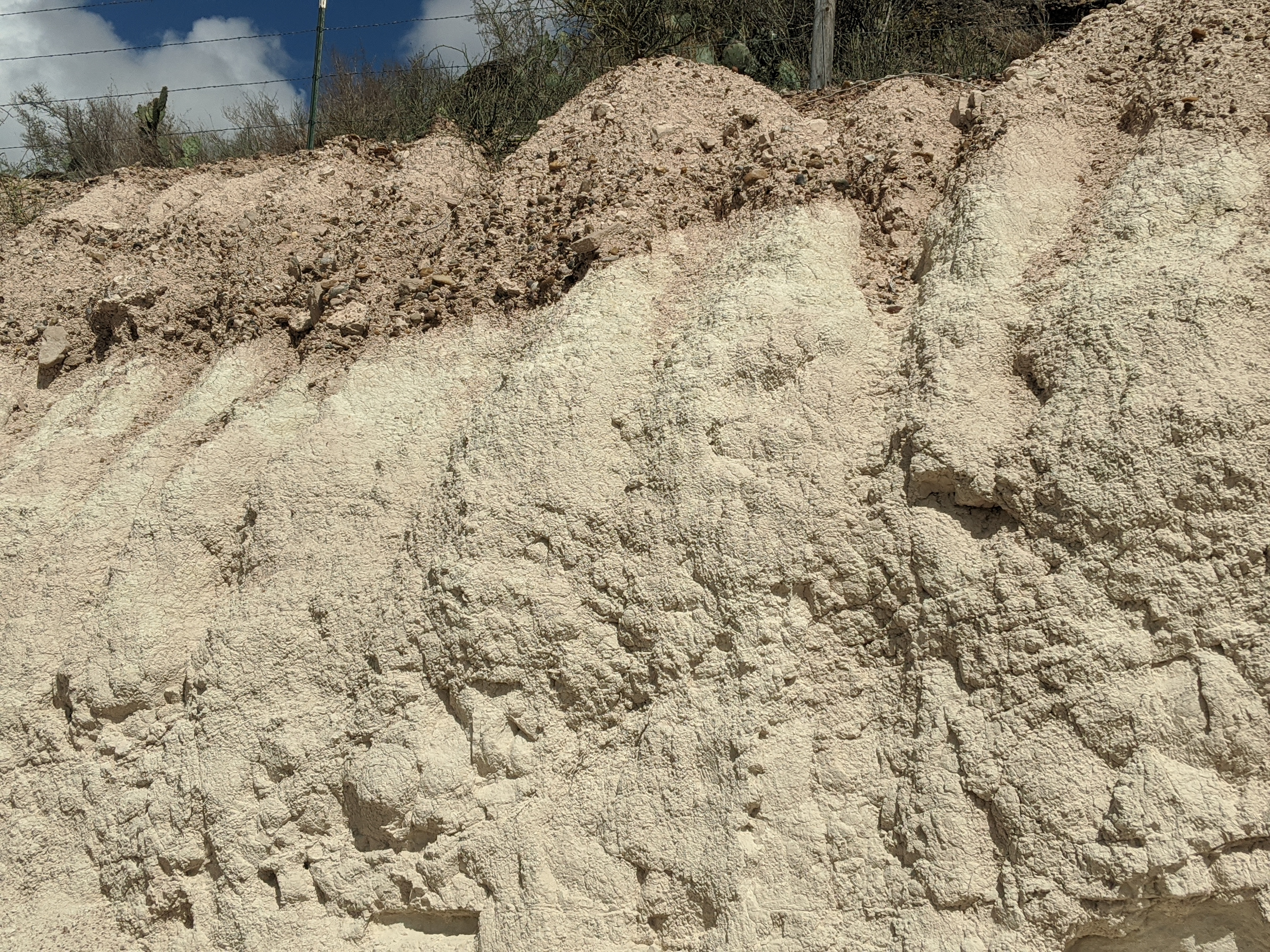
There are three easily accessible outcrops of the volcanic ash in the vicinity of Rio Grande City where it can be inspected, 1- behind Martinez Diesel Repair on the north side of HWY 83, just past the walled portion of the highway traveling west, 2- at the intersection of Tampico St. and Hidalgo Ave., this is the best exposure where 17 m of uninterrupted ash can be seen, and 3- at the La Santa Cruz shrine at the intersection of Hillside and Santa Cruz Rd.
Now visible as clay, the material in these outcrops was deposited as volcanic ash. The silica rich ash weathered over time to become the fine grained, white colored clay. So rich in silica, quartz crystals will precipitate out of the ash over time as rain water infiltrates. The source of the eruption that produced this ash is unknown but occurred 27 MYA. The ash is ~20 meters thick and bounded on the top by an unconformity with the Goliad formation. The base is in contact with the Lower Catahoula, Frio formation. The ash is part of the Catahoula formation but the outcrops here provide excellent viewing locations.

There is a 60-foot-thick deposit known in the geologic literature as the Catahoula volcanic ash that is visible along the main highway in Starr County. It formed 27-million-years ago when a caldera erupted violently and injected a large volume of volcanic ash into the atmosphere. The ash was transported by the prevailing winds; it eventually rained down on the Earth’s surface, which at the time was near the shoreline of the Gulf of Mexico along a broad coastal plain, which stretched northward along the Gulf Coast for over 130 miles. The thick blanket of ash changed the landscape forever, burying all plants and landforms. The ash accumulated over a short time of perhaps a few days to a few weeks. The exact location of the caldera is uncertain, but it likely had a westerly source, and was one of many active volcanic centers in the Sierra Madre Occidental, over 310 miles to the southwest in Mexico. This postulation is based on its age (27 million years), and the chemical affinity.
The high volume of ash put in the atmosphere by the eruption was, without a doubt, a catastrophic event with devastating consequences for the region’s climate, ecology and environments Millions of years later evidence of this past landscape are sometimes reveals in the fossilized impressions or molds of plants. Also, after millions of years silica dissolved from the ash by groundwater replaced the cellulose of the buried trees resulting in a Petrified Forest.
Thick exposures of the almost pure white Catahoula Volcanic Ash can be seen along US HIGHWAY 83 between Rio Grande City and the town of Escobares.
Listen to the English podcast - The Catahoula Volcanic Ash
A lo largo de la carretera principal del condado de Starr se puede observar un depósito de casi 20 metros de grosor de lo que se conoce dentro del ámbito de la geología como «ceniza volcánica de Catahoula». Este se formó hace 27 millones de años a partir de la violenta erupción de una caldera volcánica que inyectó en la atmósfera un gran volumen de ceniza. Transportado por los vientos imperantes, el material expulsado acabó precipitándose con la lluvia sobre la superficie terrestre, en concreto en una franja de más de 200 kilómetros a lo largo de las amplias llanuras costeras cercanas a las playas de donde entonces se ubicaba el Golfo de México. El grueso manto de ceniza alteró el paisaje de manera definitiva, soterrando toda la vegetación y accidentes geográficos en un breve periodo de tiempo que iría quizás desde unos pocos días a apenas unas semanas. La localización exacta de esta erupción sigue siendo una incógnita, aunque parece que la ceniza procediera de una zona más hacia el oeste, pues la caldera pudiera ser parte de uno de los múltiples centros volcánicos activos en la Sierra Madre Occidental, a unos 500 kilómetros en dirección suroeste, en México. Se postula esta posibilidad debido a la afinidad química de la ceniza y a su antigüedad de 27 millones de años.
El gran volumen de cenizas que la erupción vertió en la atmósfera fue, sin duda, un acontecimiento de proporciones catastróficas y consecuencias devastadoras para el clima, la ecología y el medio ambiente de la región. Millones de años después, es posible observar pruebas del antiguo paisaje en las ocasionales impresiones fósiles de plantas, también llamados «moldes». Pero también se generó un bosque petrificado resultante de la substitución durante millones de años de la celulosa de los árboles enterrados con el silicio de la ceniza disuelto en las aguas subterráneas.
Es posible observar gruesos afloramientos de las cenizas volcánicas de Catahoula de un color casi blanco puro en la carretera nacional 83 entre Rio Grande City y el municipio de Escobares.
Escucha en Español –las cenizas volcánicas de Catahoula
