skip to main content
UTRGV The University of Texas Rio Grande Valley
Main Menu
Donate Now Directory myUTRGV

You are here:

Ancient Landscapes of South Texas 27 MYA Catahoula Volcanic Ash El Sauz Chert

Ancient Landscapes of South Texas College of Liberal Arts

  • Home
  • Ancient Landscapes of South Texas
    • La Villa Meteorite
    • 43 MYA Gulf of Mexico Shoreline
      • Roma Sandstone
      • Roma Bluffs - Historic District
      • Roma Sandstone - Chapeno Rapids
      • Mortar Holes
      • San Ygnacio Trevino Fort
      • Giant Oysters
      • Oligocene Shoreline
      • Coal
    • 27 MYA Catahoula Volcanic Ash
      • Catahoula Volcanic Ash
      • El Sauz Chert
      • Petrified Wood
      • Pozzolana - Falcon Dam
    • Goliad Gravels
    • La Sal del Rey
    • Modern Shorelines
      • Tidal Flats & Algal Mats
    • South Texas Sand Sheet
      • Sand Dunes
      • Deflation Troughs
      • Norias - Hand-Dug Water Wells
      • Wind Turbines
    • Pleistocene Megafauna
      • Late Pleistocene Delta
      • Giant Tortoise Fossils
    • The Rio Grande
      • Resacas
      • Montezuma Cypress Tree
      • Rio Rico
    • Caliche
  • About Us
    • Faculty and Staff
    • Our Mission
  • Press
  • Academic Resources
    • Publications
    • Educational Tools
      • Short Films – Epochs
    • K-12 Integrated Multidisciplinary Lesson Plan Book
      • Supplemental Teaching Tools
  • Attractions
    • Zapata County Museum of History
    • UTRGV Planetarium and Geology Lab
    • UTRGV Coastal Studies Lab (SPI)
    • Quinta Mazatlan
    • Museum of South Texas History
    • Rancho Lomitas
  • Donate
  • Workshop

27 MYA Catahoula Volcanic Ash - Related Links

  • Catahoula Volcanic Ash
  • El Sauz Chert
  • Petrified Wood
  • Pozzolana - Falcon Dam

Contact Us

Ancient Landscapes of South Texas Program
The University of Texas Rio Grande Valley
1201 W. University Dr.
LAMR 1.103
Conference Room LAMR 1.104
Email: chaps@utrgv.edu
Phone: (956) 665-3231

Quick Links

  • CHAPS
  • Discovery Trails
  • Sponsorship Opportunities
  • UTRGV Geology Club
  • RGV Civil War Trail

El Sauz Chert

El Sauz Chert

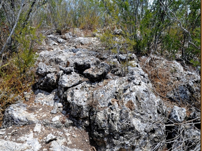
Chert is a sedimentary rock composed of microcrystalline quartz, the mineral form of silicon dioxide (SiO2). It occurs in a range of colors and is best known for being the most common rock used in prehistory to make stone tools. El Sauz is a distinct type of chert, unique to Starr County. It was first described in the 1970s after archeologists noted projectile points made from a rock with unusual colorations and textures. It outcrops in two small mounds, 30 m(L) by 15 m(H), that served as quarries for thousands of years; these are located on private land, 16 kilometers due north of Rio Grande City.

Most cherts form either as irregular nodules known as concretions, when formed from the slow replacement of limestone (CaCO3) by silica (SiO2), or as layered deposits when formed on the ocean floor by the accumulation of remains of microscopic organisms (diatoms and radiolarians) with silica rich shells. El Sauz Chert however, formed within the Catahoula ash when ground water ground water circulating through the ash, altered it to clays, and mobilized the silica locally transforming it into chert, in a process that took millions of years. The bulk of this chert is light to medium gray, but approximately 10 percent of the samples found exhibit a wide range of colorations including pink, red, yellow, orange, purple, green, and caramel, which occur as irregularly shaped patches and smeared-out colorations rather than solid colors. A unique feature, which also occurs in a small percentage of the samples are the network of millimeter thick veins of opal which fluoresce yellow-green when exposed to ultraviolet light due to the presence of uranium oxide minerals.

Today El Sauz Chert is recognized as an important lithic resource that was extensively used by stone-tool makers in prehistoric times in the Lower Rio Grande Valley. Recent studies have demonstrated that up to 6 percent of all stone tools in the regions were made from it. In Paleo-Indian (~9,000 years BP), and Archaic times (~8,000 - 1,000 years BP) it was used to make dart and spear points (Golondrina, Hidalgo, Pedernales, Refugio, Matamoros), and in Late Prehistoric and Historic times (~1,000 - 300 years BP) to make arrowheads, (Guerrero, Fresno).

Jump to Top

UTRGV

  • Twitter
  • Facebook
  • LinkedIn
  • YouTube
  • CARES, CRRSAA and ARP Reporting
  • Site Policies
  • Contact UTRGV
  • Required Links
  • Fraud Reporting
  • Senate Bill 18 Reporting
  • UTRGV Careers
  • Clery Act Reports
  • Web Accessibility
  • Mental Health Resources
  • Sexual Misconduct Policy
  • Reporting Sexual Misconduct