
The University of Texas Rio Grande Valley
Military and Veterans Success Center Student Support

9/11 Commemorative Event

The Military & Veterans Success Center in collaboration with University Recreation and ROTC invites you to participate in:

9/11 Commemorative Walk 
September 11th, 2026

Join us as we commemorate the anniversary of September 11th by collectively walking to remember those killed and honor the heroes who put their own lives at risk to save others.

Choose a location to participate:


BROWNSVILLE: September 11, 2026

Start time: 7:00 AM
Location: UTRGV Brownsville campus, Meet at BSTUN 
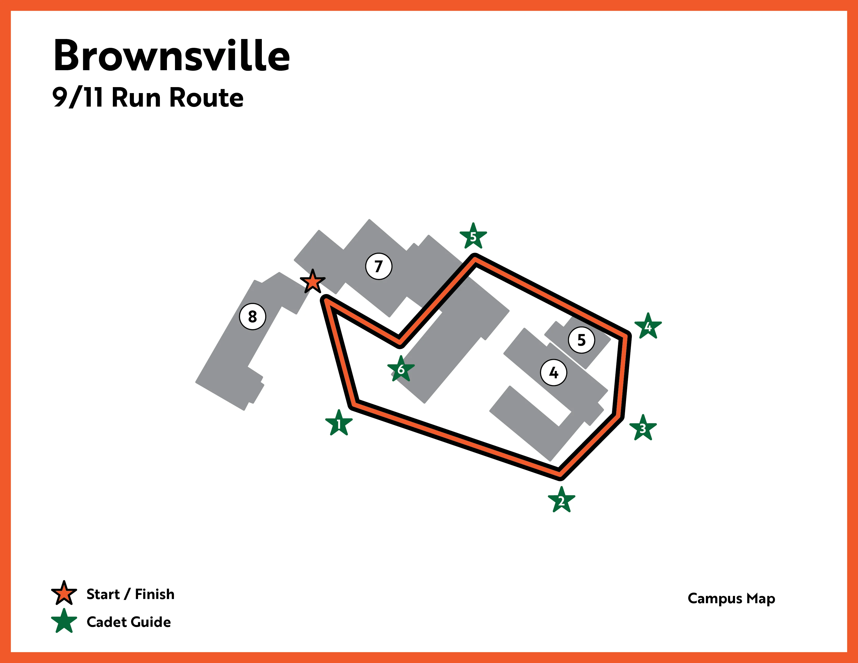
Map of the UTRGV Brownsville Campus for the 9/11 Commemorative Run/Walk. The route begins and ends at the Student Union, identified as the Start/Finish location near map reference "BSTUN Map #8." The course follows a loop through the campus and is marked with six numbered checkpoints:      Marker 1: First point reached after departing the Student Union.     Marker 2: Second route marker along the course.     Marker 3: Third checkpoint on the route.     Marker 4: Fourth checkpoint as the route continues around campus.     Marker 5: Fifth checkpoint approaching the return segment.     Marker 6: Final checkpoint before returning to the Student Union finish area.  Roadway references shown on the map include Ringgold Road and East Jackson Street, which provide geographic orientation around the campus. Essential information conveyed by the map: participants start at the Student Union, follow the marked course in numerical order from 1 through 6, and return to the Student Union to finish the event.


EDINBURG: September 11, 2026

Start time: 7:00 AM
Location: UTRGV Edinburg campus, Meet at the flagpole
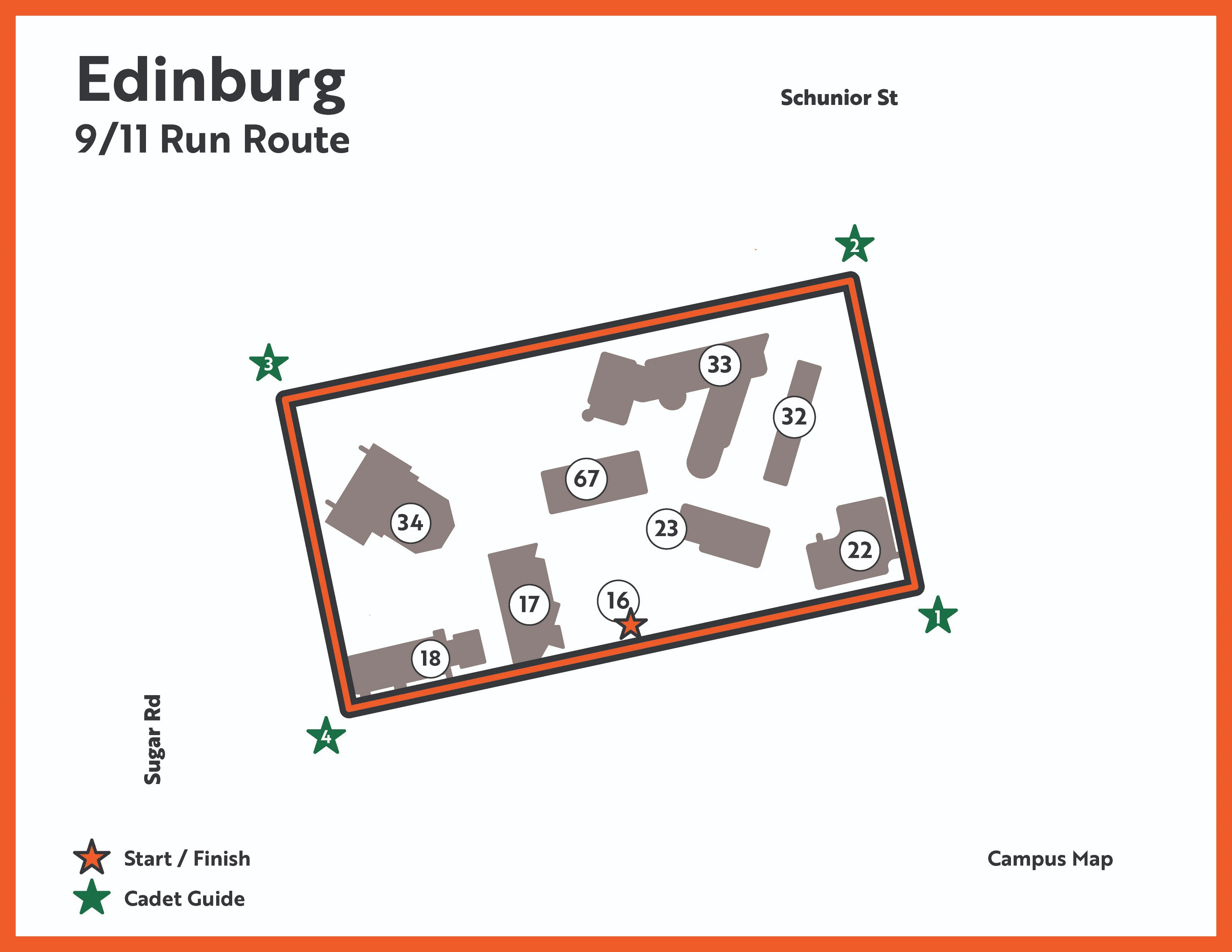
Map of the UTRGV Edinburg Campus for the 9/11 Commemorative Run/Walk. The route begins and ends at the Flagpole, identified as the Start/Finish location near map reference "ECHAP Map #16."The course follows a loop through the campus and is marked with four numbered checkpoints:      Marker 1: First point on the route after leaving the start area.     Marker 2: Route continues through the campus.     Marker 3: Mid-course marker along the loop.     Marker 4: Final marker before returning to the start/finish area.  Roadway references shown on the map include Sugar Road and Schunior Street, which border the campus area used for orientation. Essential information conveyed by the map: participants start at the Flagpole, follow the marked loop in numerical order from 1 through 4, and return to the same location for the finish.